Drone Mapping That’s Field-Tested and Ready for Your Next Project
Every week, I’m out flying drones collecting LiDAR, capturing aerial imagery, or running mobile mapping collections for real-world Survey, Engineering, and Land Development projects. I’m not just a content creator – I’m your Remote Sensing Operations Leader. All professional services or licensed work is delivered through my employer, a licensed surveying firm based in Virginia with licenses across much of the United States. If you’re looking for Drone Survey, Mapping, or LiDAR for Engineering and Land Development, you’re in the right place.
It’s what I do.
Do you need drone LiDAR, photo mapping, aerial topographic surveys, 360 imagery collection, or mobile mapping? I can help you collect the data you need – accurately and efficiently. If you need post processing support I am here as well.
Drone & Manned
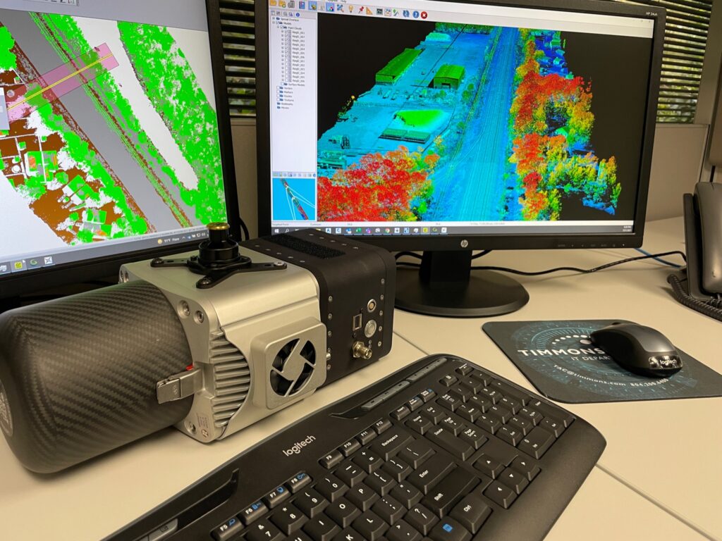
LiDAR Collection
High-density aerial LiDAR data for topographic surveys, utility corridors, and large-area mapping.
Photogrammetry & Orthomosaics
High-resolution RGB imagery with survey-grade accuracy for civil and site plans.
Mobile Mapping &
360 Imagery
Streetview-style data for asset inventories, inspections, and documentation.
Workflow Support for Engineers & Surveyors
Pre-planning, flight ops, and post-processing.
Real Projects. Real Results.
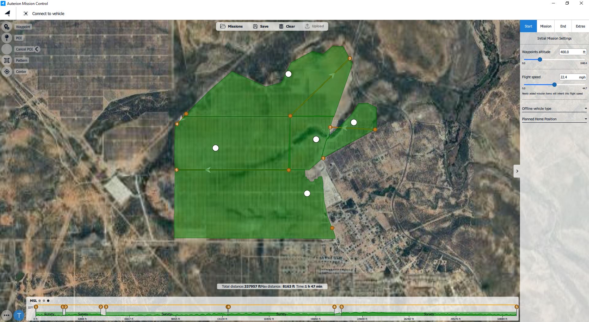
1,300 Acres of Utility-Scale Solar Mapped in a Day
Using drone LiDAR and photogrammetry to deliver accurate as-built data in under a week.
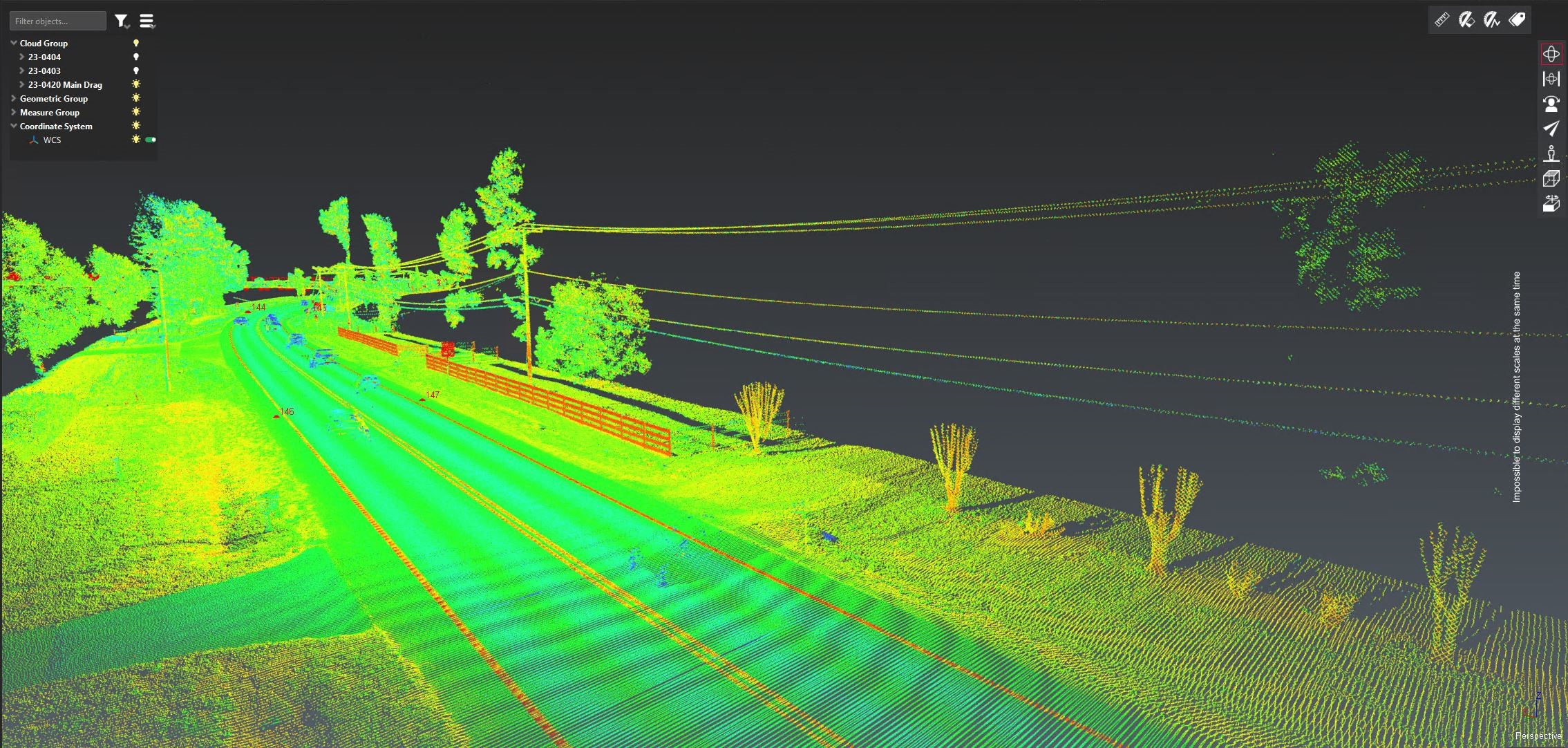
County wide Mobile Mapping LiDAR & 360 Imagery
Used for both asset inventory and GIS foundational data.
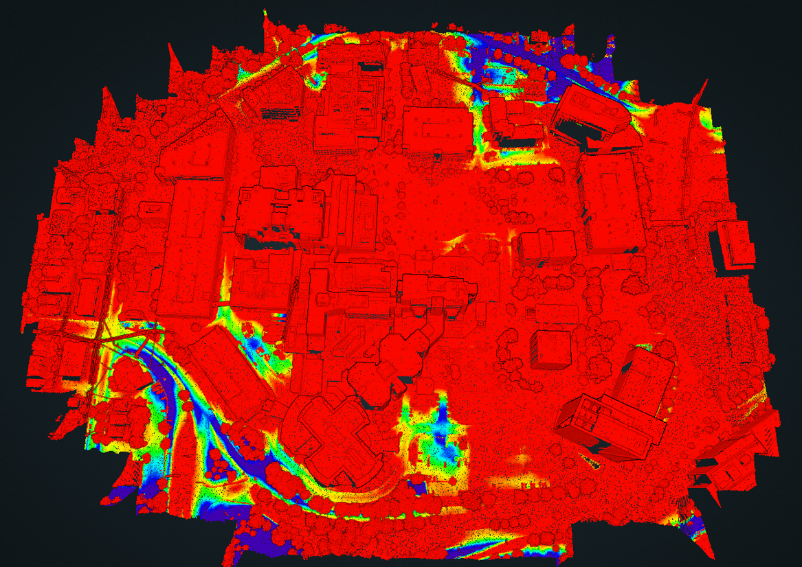
100 year flood modeling
LiDAR and photo mapping data to support 100-year flood modeling
Drone Mapping Insights from the Field
I share honest, practical breakdowns of LiDAR workflows, drone tech, and real missions. These aren’t studio videos – they’re straight from the field.
Why I Still Use Ground Control with RTK Drone Mapping
Need Drone LiDAR for Land Development & Surveying? | Let’s Talk.
I support licensed deliverables through my employer, a licensed surveying firm. Whether you’re a civil engineer, surveyor, or land developer, I can help you scope, fly, and deliver the data you need so that you can make informed decisions.
About David – That Drone Guy
I’ve spent the last 10+ years in the drone mapping and remote sensing world – planning missions, flying drones, collecting LiDAR, and supporting licensed surveys across the U.S. and internationally. I’m the Director of Remote Sensing for a licensed surveying firm, where I lead drone and mobile mapping operations for topographic surveys, as-builts, and large-scale mapping projects.
All regulated survey deliverables are produced through my firm, not as an individual. I create content to share what I’ve learned and to help others explore drone workflows in the real world.
Home | Services | Projects | Blog | Contact
David Barton is not a licensed surveyor. All professional services or licensed survey work and deliverables are completed under the direct supervision of a licensed surveyor through his employer, a licensed surveying firm based in Virginia with licenses across most of the United States.